
Anúncios
Remote sensing technology is transforming how we manage Earth’s resources, offering unprecedented accuracy and efficiency in monitoring environmental changes, agricultural productivity, and natural resource allocation across vast geographical areas.
🌍 The Evolution of Resource Management Through Technology
Traditional resource management methods relied heavily on manual surveys, ground-based observations, and localized data collection. These approaches, while valuable, presented significant limitations in terms of scale, frequency, and cost-effectiveness. The advent of remote sensing technology has fundamentally altered this landscape, introducing capabilities that were once considered impossible.
Anúncios
Remote sensing encompasses various technologies including satellite imagery, aerial photography, LiDAR systems, and drone-based sensors. These tools capture data across multiple spectral bands, enabling scientists and resource managers to observe phenomena invisible to the human eye. The integration of these inputs into resource management models has created a paradigm shift in how we understand and interact with our environment.
Modern resource management demands real-time data, comprehensive coverage, and predictive capabilities. Remote sensing delivers on all these fronts, providing consistent, repeatable observations that span from local agricultural fields to entire continents. This technological revolution has made accurate modeling not just possible but increasingly accessible to organizations of all sizes.
Anúncios
📡 Understanding Remote Sensing Data Sources
The foundation of effective resource management models lies in understanding the diverse array of remote sensing inputs available today. Each data source offers unique advantages and specific applications that contribute to comprehensive environmental monitoring.
Satellite-Based Observations
Satellite platforms provide the most extensive coverage for resource monitoring. Systems like Landsat, Sentinel, and MODIS offer free, publicly available imagery with varying spatial and temporal resolutions. These satellites capture data across multiple wavelengths, from visible light to thermal infrared, enabling diverse applications from vegetation health assessment to water quality monitoring.
Commercial satellite operators have further expanded capabilities with high-resolution imagery reaching sub-meter precision. Companies like Planet Labs operate constellations of small satellites that can image the entire Earth daily, providing unprecedented temporal frequency for change detection and monitoring applications.
Aerial and Drone Technology
Unmanned aerial vehicles (UAVs) have democratized remote sensing, bringing sophisticated monitoring capabilities to individual farms, municipalities, and research projects. Drones equipped with multispectral, hyperspectral, or LiDAR sensors can collect extremely detailed data over targeted areas, complementing broader satellite observations with localized, high-resolution information.
The flexibility of drone deployment allows for customized flight schedules responsive to specific events or conditions. This agility makes drones particularly valuable for precision agriculture, disaster response, and infrastructure monitoring where timely, detailed information drives decision-making.
🔬 Key Applications in Resource Management
Remote sensing inputs have revolutionized multiple domains of resource management, each benefiting from the technology’s unique capabilities to monitor, measure, and model complex systems accurately.
Agricultural Optimization and Precision Farming
Agriculture represents one of the most successful applications of remote sensing technology. Farmers and agronomists now utilize satellite and drone imagery to monitor crop health, detect pest infestations, optimize irrigation, and predict yields with remarkable accuracy.
Vegetation indices derived from multispectral imagery, such as NDVI (Normalized Difference Vegetation Index), provide quantitative measures of plant health and vigor. These indices enable early detection of stress conditions before they become visible to the human eye, allowing for targeted interventions that save resources and maximize productivity.
Precision agriculture platforms integrate remote sensing data with ground-based sensors, weather information, and historical records to create comprehensive models. These models guide variable-rate application of water, fertilizers, and pesticides, reducing waste while improving yields. The economic and environmental benefits are substantial, with studies showing resource savings of 15-30% while maintaining or increasing production.
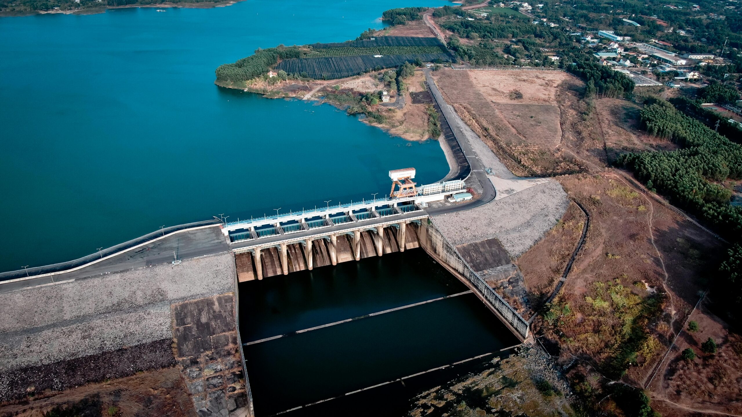
Water Resource Management
Water scarcity challenges are intensifying globally, making efficient water management critical. Remote sensing provides essential inputs for monitoring surface water extent, reservoir levels, soil moisture, and evapotranspiration rates across watersheds and agricultural regions.
Thermal infrared sensors detect temperature differences that indicate water stress in vegetation or reveal groundwater discharge areas. Radar systems penetrate cloud cover and can measure soil moisture at various depths, crucial information for drought monitoring and irrigation planning.
Integrated water management models incorporate these remote sensing inputs alongside hydrological data to forecast availability, allocate resources among competing users, and detect illegal water extraction. Authorities in water-stressed regions increasingly rely on these models for evidence-based policy decisions.
Forest and Biodiversity Conservation
Protecting forest resources requires monitoring vast, often inaccessible areas for deforestation, degradation, and biodiversity changes. Remote sensing offers the only practical solution for comprehensive forest monitoring at regional and global scales.
Advanced classification algorithms applied to satellite imagery can distinguish forest types, measure canopy height and density, estimate biomass, and detect subtle changes indicating early-stage degradation. These capabilities support both enforcement of conservation regulations and scientific understanding of ecosystem dynamics.
Conservation organizations combine optical and radar satellite data to create near-real-time deforestation alert systems. These systems have proven instrumental in reducing illegal logging by enabling rapid response to detected changes, dramatically improving the effectiveness of limited enforcement resources.
⚙️ Building Accurate Models with Remote Sensing Data
The true power of remote sensing emerges when raw data transforms into actionable models that predict conditions, optimize decisions, and reveal patterns invisible in individual observations.
Data Processing and Calibration
Raw remote sensing data requires substantial processing before integration into models. Atmospheric correction removes distortions caused by air particles and moisture, geometric correction aligns images to real-world coordinates, and radiometric calibration ensures consistent measurements across different sensors and time periods.
Quality control procedures identify and flag problematic data from cloud contamination, sensor malfunctions, or processing errors. Automated pipelines now handle much of this preprocessing, but expert oversight remains essential for ensuring data reliability in critical applications.
Machine Learning and Artificial Intelligence Integration
Modern resource management models increasingly leverage machine learning algorithms to extract patterns and relationships from complex, multidimensional remote sensing datasets. Deep learning approaches, particularly convolutional neural networks, excel at image classification tasks like identifying crop types, detecting changes, or mapping land cover.
These algorithms learn from training data that pairs remote sensing observations with known ground conditions. Once trained, they can process new imagery automatically, scaling analysis to vast areas that would be impractical for manual interpretation. The accuracy of machine learning models often exceeds traditional analytical methods, particularly when abundant training data is available.
Random forests, support vector machines, and other algorithms handle regression problems like yield prediction or biomass estimation. These models identify complex relationships between spectral signatures, environmental variables, and target outcomes, enabling predictions that inform resource allocation and planning decisions.
Validation and Accuracy Assessment
Model accuracy determines utility in real-world applications. Rigorous validation procedures compare model predictions against independent ground truth data, quantifying errors and identifying systematic biases that might undermine decision-making.
Cross-validation techniques partition data into training and testing sets, ensuring models perform well on new observations rather than simply memorizing training examples. Spatial cross-validation accounts for geographic autocorrelation, providing realistic performance estimates for models applied across landscapes.
Continuous validation using new data streams maintains model relevance as conditions change. Feedback loops that incorporate user observations and outcomes enable adaptive models that improve over time, learning from successes and failures in actual deployment.
🚀 Emerging Technologies and Future Directions
The remote sensing revolution continues accelerating as new technologies expand capabilities and reduce costs, promising even more transformative impacts on resource management in coming years.
Hyperspectral Imaging Advances
While traditional multispectral sensors capture data in several broad wavelength bands, hyperspectral systems record hundreds of narrow, contiguous bands across the spectrum. This detailed spectral information enables identification of specific minerals, plant species, or chemical compounds impossible with broader sensors.
Previously limited to specialized aircraft missions, hyperspectral technology is transitioning to satellite platforms, bringing these advanced capabilities to routine operational monitoring. Applications in precision agriculture, mineral exploration, and environmental contamination detection will expand dramatically as hyperspectral data becomes more accessible.
Internet of Things Integration
The convergence of remote sensing with ground-based Internet of Things (IoT) sensor networks creates comprehensive monitoring systems that combine the broad coverage of satellites with the detailed, continuous measurements of field sensors. This integration enables models that capture both spatial patterns and temporal dynamics with unprecedented completeness.
Smart agriculture platforms exemplify this integration, combining satellite imagery with soil moisture sensors, weather stations, and equipment telemetry to optimize every aspect of farm operations. The synergy between remote and proximal sensing delivers insights neither data source could provide independently.
Cloud Computing and Big Data Analytics
The volume of remote sensing data now exceeds what traditional computing approaches can handle effectively. Cloud-based platforms like Google Earth Engine, Amazon Web Services, and Microsoft Planetary Computer provide the computational infrastructure necessary to process and analyze petabytes of imagery.
These platforms democratize access to both data and computing power, enabling researchers and organizations without substantial IT infrastructure to develop sophisticated models. Pre-processed analysis-ready data and libraries of algorithms accelerate development, reducing the time from concept to operational system.
💡 Overcoming Implementation Challenges
Despite tremendous potential, organizations face several challenges when implementing remote sensing-based resource management systems. Understanding and addressing these obstacles is essential for successful deployment.
Technical Capacity and Expertise
Effectively utilizing remote sensing requires specialized knowledge spanning sensor physics, image processing, spatial statistics, and domain-specific expertise. Many organizations struggle to recruit or develop staff with this multidisciplinary skillset.
Training programs, partnerships with academic institutions, and consultancy services can bridge capacity gaps. Additionally, user-friendly software tools and cloud platforms increasingly abstract technical complexity, making advanced capabilities accessible to users without deep technical backgrounds.
Data Integration and Interoperability
Resource management models typically require integrating remote sensing data with various other information sources including weather data, soil maps, administrative boundaries, and historical records. Differences in formats, coordinate systems, and temporal resolutions complicate this integration.
Standardized data formats and metadata schemas facilitate interoperability. Initiatives like the Open Geospatial Consortium establish technical standards that enable diverse systems to exchange and utilize data seamlessly. Investing in robust data management infrastructure pays dividends in analytical efficiency and model reliability.
Cost-Benefit Considerations
While many remote sensing data sources are freely available, developing and operating sophisticated models requires investment in expertise, software, and computing infrastructure. Organizations must carefully evaluate whether benefits justify these costs for their specific applications.
Starting with pilot projects targeting high-value problems allows organizations to demonstrate value before scaling investment. Many successful implementations began modestly, proving concepts and building expertise before expanding to enterprise-wide systems.
🌱 Practical Steps for Getting Started
Organizations seeking to leverage remote sensing for resource management can follow a structured approach to ensure successful implementation and maximize return on investment.
Begin by clearly defining management objectives and the specific decisions that improved information would support. Identifying concrete use cases focuses efforts on applications where remote sensing provides genuine value rather than pursuing technology for its own sake.
Assess available data sources relevant to your objectives, considering both free public data and commercial options. Many applications can succeed with freely available satellite imagery, reserving commercial data purchases for situations requiring higher resolution or specialized sensors.
Develop or acquire initial models using simple approaches before progressing to sophisticated methods. Often, straightforward vegetation indices or change detection algorithms deliver substantial value without the complexity of advanced machine learning. Building confidence and demonstrating results with simpler methods creates momentum for more ambitious projects.
Establish validation procedures early in the process. Regular comparison of model outputs against ground observations builds confidence in results and identifies areas needing refinement. Documentation of accuracy and limitations ensures users interpret information appropriately.
Plan for operational sustainability by considering ongoing data acquisition, processing workflows, model updating, and user support. Systems that work perfectly in initial implementation can fail if operational requirements are not adequately resourced.
🎯 Measuring Success and Impact
Evaluating the impact of remote sensing-based resource management systems requires metrics that capture both technical performance and real-world outcomes. Technical accuracy measures like root mean square error or classification accuracy indicate model quality but don’t directly reflect value delivered.
Operational metrics such as resource use efficiency, cost savings, yield improvements, or reduced environmental impacts demonstrate tangible benefits. In agriculture, measuring fertilizer savings, water use reduction, or yield increases quantifies the return on investment in precision management enabled by remote sensing.
For conservation applications, metrics might include hectares of forest protected, reduction in illegal activity, or improvements in biodiversity indicators. These outcome-focused measures communicate value to stakeholders and justify continued investment.
User adoption and satisfaction indicate whether systems deliver information in forms that genuinely support decision-making. Regular engagement with end-users identifies opportunities for improvement and ensures systems evolve to meet changing needs.
🔮 The Path Forward: Scaling Impact
Remote sensing technology has already transformed resource management in numerous sectors and regions, yet we have only begun to tap its full potential. The continued evolution of sensors, platforms, algorithms, and delivery mechanisms promises even greater capabilities and accessibility.
Success stories from early adopters provide blueprints for organizations beginning their remote sensing journey. Agricultural cooperatives achieving significant resource savings and yield improvements, water authorities optimizing allocation during droughts, and conservation programs protecting critical ecosystems demonstrate the technology’s transformative potential.
As climate change intensifies pressure on natural resources, the need for accurate, timely information becomes ever more critical. Remote sensing-based models provide the insights necessary to navigate this challenging future, enabling adaptation strategies grounded in solid evidence rather than guesswork.
The democratization of remote sensing technology through free data, cloud computing platforms, and open-source tools means organizations of all sizes can participate in this revolution. Small farms, municipal governments, and non-profit organizations now access capabilities once reserved for well-funded national programs or large corporations.
Collaborative approaches that share data, methods, and insights accelerate progress across the field. Open science initiatives, international partnerships, and knowledge-sharing networks multiply the impact of individual efforts, building collective capacity to address shared resource management challenges.
The integration of remote sensing inputs into resource management models represents not just a technological advancement but a fundamental shift in how humanity relates to and stewards the natural systems supporting our civilization. By leveraging these powerful tools wisely, we can achieve the delicate balance between meeting human needs and preserving the environmental systems essential for long-term prosperity.